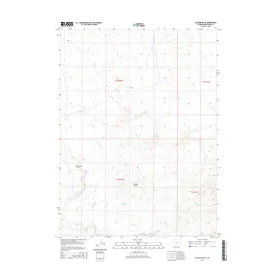
2015 Map of Salazar Butte
USGS Topo · Published 2015About this map
Salazar Butte stands as the central landmark in this high-altitude landscape of Sweetwater County, defined by a network of seasonal drainages and local water management. The topography is anchored by the Willow Creek Rim to the west, while the desert floor is marked by the presence of Willow Reservoir and Salazar Reservoir. These water sources, crucial in this arid environment, connect via the W Br Willow Cr and E Br Willow Cr, illustrating the vital hydrology of the region. The map reveals a remote area managed by the Bureau of Land Management, where navigation is largely defined by routes such as Blm-4411 and the winding course of Shallow Cr. This document provides a clear view of the land use and natural landmarks in southern Wyoming during the early twenty-first century.
Find a feature on this map
12 named features on this map. Tap any name to fly to it.
Don’t see what you’re looking for? This feature index may not catch every label — zoom into the map to look around manually.
Map Details
Editions of this 2015 Salazar Butte Map
This is the sole edition of this map. No revisions or reprints were ever made.
Other maps of this area

1954 · Rawlins
USGS Topo · 1:250,000

1954 · Rock Springs
USGS Topo · 1:250,000

1958 · Rawlins
USGS Topo · 1:250,000

1958 · Rock Springs
USGS Topo · 1:250,000

1962 · Rawlins
USGS Topo · 1:250,000

1962 · Rock Springs
USGS Topo · 1:250,000

1967 · Rawlins
USGS Topo · 1:250,000

1970 · South Barrel Spring
USGS Topo · 1:24,000

1970 · Prehistoric Rim
USGS Topo · 1:24,000
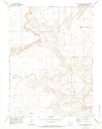
1970 · Powder Mountain NE
USGS Topo · 1:24,000