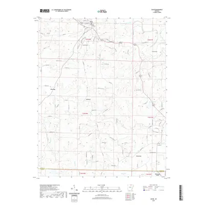
2020 Map of Salem
USGS Topo · Published 2020About this map
The Fulton County Courthouse anchors the county seat of Salem, positioned near the northern edge of this Ozark foothills landscape. This modern survey reflects the rural character of northern Arkansas, where the South Fork Spring River and its tributaries, such as Town Cr and Moore Br, carve through the terrain. The presence of the Salem Airport and a detailed network of county roads, including Wheeling Rd and Morriston Rd, highlights the area's continued role as a regional hub for transportation and administration.
Find a feature on this map
92 named features on this map. Tap any name to fly to it.
Don’t see what you’re looking for? This feature index may not catch every label — zoom into the map to look around manually.
Map Details
Editions of this 2020 Salem Map
This is the sole edition of this map. No revisions or reprints were ever made.
Other maps of this area

1950 · Salem
USGS Topo · 1:62,500

1951 · Salem
USGS Topo · 1:62,500

1951 · Melbourne
USGS Topo · 1:62,500

1957 · Poplar Bluff
USGS Topo · 1:250,000

1959 · Poplar Bluff
USGS Topo · 1:250,000

1960 · Poplar Bluff
USGS Topo · 1:250,000

1962 · Myron
USGS Topo · 1:24,000

1962 · Agnos
USGS Topo · 1:24,000
1962 · Camp
USGS Topo · 1:24,000
1976 · Salem SW
USGS Topo · 1:24,000