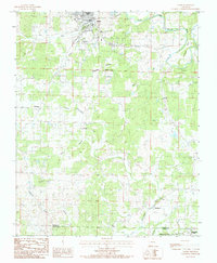
1984 Map of Salem
USGS Topo · Published 1984About this map
Salem serves as the focal point of this northern Arkansas landscape, situated where Town Creek joins the South Fork Spring River. The settlement pattern in the early 1980s reveals a mix of civic infrastructure and rural outposts, with City Hall and the Municipal Airport anchoring the town center. Moving south across the Fulton Co Izard Co line, the terrain is defined by a complex network of waterways including the Little Strawberry River and its various tributaries like Raney Branch and Hubble Branch.
Find a feature on this map
25 named features on this map. Tap any name to fly to it.
Don’t see what you’re looking for? This feature index may not catch every label — zoom into the map to look around manually.
Map Details
Editions of this 1984 Salem Map
This is the sole edition of this map. No revisions or reprints were ever made.
Other maps of this area

1950 · Salem
USGS Topo · 1:62,500

1951 · Salem
USGS Topo · 1:62,500

1951 · Melbourne
USGS Topo · 1:62,500

1957 · Poplar Bluff
USGS Topo · 1:250,000

1959 · Poplar Bluff
USGS Topo · 1:250,000

1960 · Poplar Bluff
USGS Topo · 1:250,000

1962 · Myron
USGS Topo · 1:24,000

1962 · Agnos
USGS Topo · 1:24,000
1962 · Camp
USGS Topo · 1:24,000
1976 · Salem SW
USGS Topo · 1:24,000