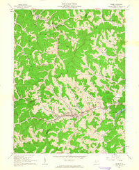
1961 Map of Salem
USGS Topo · Published 1963About this map
Salem serves as the focal point of this Harrison County landscape, where the Baltimore and Ohio railroad cuts through the valley alongside the Fork. The map illustrates a transitional period for the area, balancing industrial utility with burgeoning residential and recreational developments like Lake Floyd. To the west, the State Industrial Home and the Armory indicate the town's institutional importance, while the surrounding hills are dotted with a high density of Gas Wells, reflecting the region's deep ties to the natural gas industry.
Find a feature on this map
65 named features on this map. Tap any name to fly to it.
Don’t see what you’re looking for? This feature index may not catch every label — zoom into the map to look around manually.
Map Details
Editions of this 1961 Salem Map
2 editions found
Other maps of this area

1902 · Clarksburg
USGS Topo · 1:62,500

1904 · Weston
USGS Topo · 1:62,500

1904 · Vadis
USGS Topo · 1:62,500

1905 · Centerpoint
USGS Topo · 1:62,500

1910 · Clarksburg
USGS Topo · 1:62,500

1923 · Clarksburg
USGS Topo · 1:62,500

1924 · Centerpoint
USGS Topo · 1:62,500

1925 · Clarksburg
USGS Topo · 1:62,500

1925 · Centerpoint
USGS Topo · 1:62,500

1925 · Vadis
USGS Topo · 1:62,500