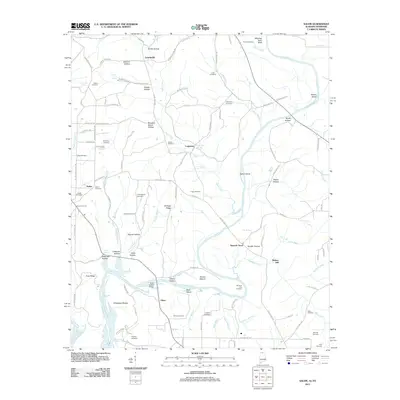
2011 Map of Salem
USGS Topo · Published 2011About this map
Elk River winds through this borderland between Tennessee and Alabama, carving a landscape defined by dramatic bends and numerous spring-fed tributaries. The terrain is marked by distinct ridges and hollows, such as Gray Ridge and Gardner Hollow, which have long shaped the settlement patterns of rural communities like Gourdsville and Leggtown. Family history is deeply rooted here, evidenced by a high density of small burial grounds including the Browning Cemetery, Cunningham Cemetery, and Grigsby Cemetery near the riverbanks.
Find a feature on this map
121 named features on this map. Tap any name to fly to it.
Don’t see what you’re looking for? This feature index may not catch every label — zoom into the map to look around manually.
Map Details
Editions of this 2011 Salem Map
This is the sole edition of this map. No revisions or reprints were ever made.
Other maps of this area

1888 · Huntsville
USGS Topo · 1:125,000

1892 · Huntsville
USGS Topo · 1:125,000

1935 · Athens
USGS Topo · 1:24,000

1936 · Union Hill
USGS Topo · 1:24,000

1936 · Aspen Hill
USGS Topo · 1:24,000

1936 · Elkmont
USGS Topo · 1:24,000

1936 · Ripley
USGS Topo · 1:24,000

1936 · Appleton
USGS Topo · 1:24,000

1936 · Cairo
USGS Topo · 1:24,000

1936 · Elkton
USGS Topo · 1:24,000