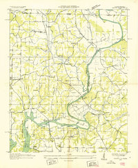
1936 Map of Salem
USGS Topo · Published 1936About this map
Wheeler Reservoir dominates the southern reaches of this landscape, its waters rising behind the newly completed dam as shown in this 1936 survey. The Tennessee Valley Authority's influence is clear, with the Reservation Boundary and the Reservoir Boundary demarcating a landscape in transition. The map captures the older rural fabric of Limestone County before complete inundation, including the Easter Ferry Bridge and the Buck Island Bridge spanning the rising Elk River. Local life centers on community hubs like Salem and the cluster of West Limestone Sch and Salem Sch. The terrain is dense with family-named landmarks and institutions, from the Legg Cem and Conniegun Cem to numerous small schoolhouses like Red Hill Sch and Buck Island Sch that served the dispersed farming population of the era.
Find a feature on this map
58 named features on this map. Tap any name to fly to it.
Don’t see what you’re looking for? This feature index may not catch every label — zoom into the map to look around manually.
Map Details
Editions of this 1936 Salem Map
This is the sole edition of this map. No revisions or reprints were ever made.
Other maps of this area

1888 · Huntsville
USGS Topo · 1:125,000

1892 · Huntsville
USGS Topo · 1:125,000

1935 · Athens
USGS Topo · 1:24,000

1936 · Union Hill
USGS Topo · 1:24,000

1936 · Aspen Hill
USGS Topo · 1:24,000

1936 · Elkmont
USGS Topo · 1:24,000

1936 · Ripley
USGS Topo · 1:24,000

1936 · Appleton
USGS Topo · 1:24,000

1936 · Cairo
USGS Topo · 1:24,000

1936 · Elkton
USGS Topo · 1:24,000