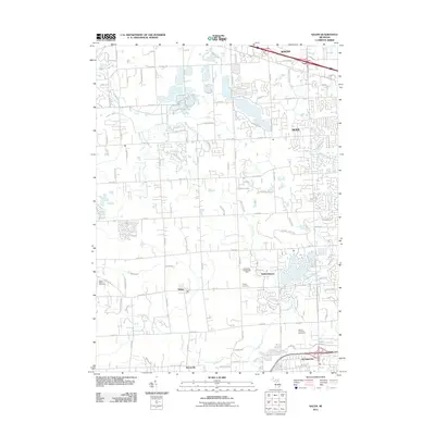
2011 Map of Salem
USGS Topo · Published 2011About this map
The Detroit House of Correction and the extensive grounds of Maybury State Park define the southeastern portion of this landscape at the turn of the decade. This 2011 survey illustrates the interface between established settlements like Northville and Novi and the evolving rural land use in Salem and Brookville. Local history is anchored by the Salem-Walker Cemetery and Thayer Cemetery, while industrial utility is noted at the Northville Gas Storage Field. A complex network of local hydrology including Johnson Drain, Sump Drain, and Thornton Creek cuts through the suburban development and agricultural plots, following the natural contours of the Oakland and Washtenaw county border area.
Find a feature on this map
100 named features on this map. Tap any name to fly to it.
Don’t see what you’re looking for? This feature index may not catch every label — zoom into the map to look around manually.
Map Details
Editions of this 2011 Salem Map
This is the sole edition of this map. No revisions or reprints were ever made.
Other maps of this area

1902 · South Lyon
USGS Topo · 1:62,500

1904 · Ann Arbor
USGS Topo · 1:125,000

1905 · Wayne
USGS Topo · 1:62,500

1906 · South Lyon
USGS Topo · 1:62,500

1907 · Pontiac
USGS Topo · 1:62,500

1908 · Ann Arbor
USGS Topo · 1:125,000

1909 · Milford
USGS Topo · 1:62,500

1912 · Wayne
USGS Topo · 1:62,500

1936 · Wayne
USGS Topo · 1:31,680

1936 · Wixom
USGS Topo · 1:31,680
Featured Places
- Novi, MI
- Northville Charter Township, MI
- Plymouth Charter Township, MI
- Lyon Charter Township, MI
- Wixom, MI