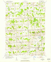
1953 Map of Salem
USGS Topo · Published 1955About this map
The boundary lines of Oakland, Washtenaw, and Wayne counties converge here in a landscape of small farming settlements and institutional facilities. The settlement of Salem serves as a focal point along the Chesapeake and Ohio railroad, while smaller hamlets like West Novi, Brookville, and Lapham Corners are linked by a precise grid of mile-roads including Tenmile Road and Eightmile Road. Local education and faith are represented by landmarks such as the West Salem Ch and several rural schoolhouses, including the Walker Sch (Abandoned).
Find a feature on this map
44 named features on this map. Tap any name to fly to it.
Don’t see what you’re looking for? This feature index may not catch every label — zoom into the map to look around manually.
Map Details
Editions of this 1953 Salem Map
This is the sole edition of this map. No revisions or reprints were ever made.
Other maps of this area

1902 · South Lyon
USGS Topo · 1:62,500

1904 · Ann Arbor
USGS Topo · 1:125,000

1905 · Wayne
USGS Topo · 1:62,500

1906 · South Lyon
USGS Topo · 1:62,500

1907 · Pontiac
USGS Topo · 1:62,500

1908 · Ann Arbor
USGS Topo · 1:125,000

1909 · Milford
USGS Topo · 1:62,500

1912 · Wayne
USGS Topo · 1:62,500

1936 · Wayne
USGS Topo · 1:31,680

1936 · Wixom
USGS Topo · 1:31,680
Featured Places
- Novi, MI
- Northville Charter Township, MI
- Plymouth Charter Township, MI
- Lyon Charter Township, MI
- Wixom, MI