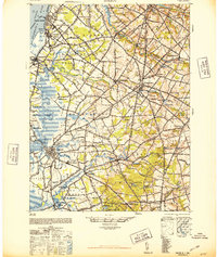
1948 Map of Salem
USGS Topo · Published 1958About this map
The industrial and agricultural waterfront of southwestern New Jersey is documented here during the post-war era, anchored by the developed centers of Penns Grove and Salem. Along the Delaware River, the map shows the strategic infrastructure of Carneys Point and Deepwater adjacent to Helms Cove. Moving inland, the landscape transitions to a network of creeks and mills that drove the local economy for generations, including Porches Mill and Watsons Mills. This survey captures the region just as the automotive age began to reshape the old transit corridors of the Pennsylvania-Reading Seashore Lines. Rural townships like Oldmans, Pilesgrove, and Mannington are shown with their numerous named corners and small settlements, such as Slapes Corner and Eldridges Hill, providing a detailed record of land use and community centers before modern suburban expansion significantly altered the Salem County interior.
Find a feature on this map
114 named features on this map. Tap any name to fly to it.
Don’t see what you’re looking for? This feature index may not catch every label — zoom into the map to look around manually.
Map Details
Editions of this 1948 Salem Map
3 editions found
Other maps of this area

1890 · Salem
USGS Topo · 1:62,500

1890 · Bay Side
USGS Topo · 1:62,500

1890 · Bridgeton
USGS Topo · 1:62,500

1890 · Glassboro
USGS Topo · 1:62,500

1891 · Philadelphia
USGS Topo · 1:62,500

1894 · Bay Side
USGS Topo · 1:62,500

1894 · Bridgeton
USGS Topo · 1:62,500

1894 · Chester
USGS Topo · 1:62,500

1894 · Philadelphia
USGS Topo · 1:62,500

1896 · Philadelphia
USGS Topo · 1:62,500