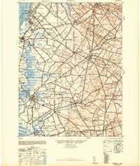
1948 Map of Salem
USGS Topo · Published 1948About this map
The Delaware River shore defines the industrial and maritime edge of this 1940s landscape, featuring heavy rail infrastructure and riverfront activity. The Pennsylvania Railroad and Reading Seashore Lines form a dense network connecting riverfront hubs like Penns Grove and Deepwater to inland agricultural and milling centers. The interior transitions into a complex system of drainage and water power, evidenced by numerous mills such as Russells Mill, Woods Mills, and Richmanville situated along the winding courses of Oldmans Creek and Raccoon Creek. Settlements like Woodstown and Swedesboro serve as primary inland junctions, while smaller hamlets like Biddles Landing and Slapes Corner speak to the area's rural heritage. This survey, revised during the war years, captures the region at a peak of rail-dependent transport before the post-war shift toward modern highway development.
Find a feature on this map
97 named features on this map. Tap any name to fly to it.
Don’t see what you’re looking for? This feature index may not catch every label — zoom into the map to look around manually.
Map Details
Editions of this 1948 Salem Map
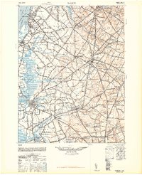
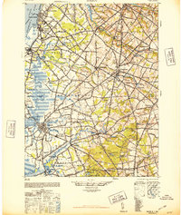
3 editions found
Other maps of this area

1890 · Salem
USGS Topo · 1:62,500

1890 · Bay Side
USGS Topo · 1:62,500

1890 · Bridgeton
USGS Topo · 1:62,500

1890 · Glassboro
USGS Topo · 1:62,500

1891 · Philadelphia
USGS Topo · 1:62,500

1894 · Bay Side
USGS Topo · 1:62,500

1894 · Bridgeton
USGS Topo · 1:62,500

1894 · Chester
USGS Topo · 1:62,500

1894 · Philadelphia
USGS Topo · 1:62,500

1896 · Philadelphia
USGS Topo · 1:62,500