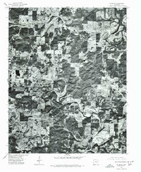
1976 Map of Salem SE
USGS Topo · Published 1977About this map
Salem sits at the northern edge of this 1976 orthophotoquad, a specialized map type that combines aerial imagery with topographic precision. The landscape of north-central Arkansas is captured here as a detailed mosaic of forest patches and cleared pastureland, revealing the rural land-use patterns of the mid-1970s. The winding course of the South Fork Spring River cuts through the eastern portion of the quadrangle, serving as a primary drainage for the area's undulating terrain. Near the western margin, the settlement of Wheeling appears as a small cluster of structures. Unlike traditional line-drawn maps, this aerial perspective allows for the direct observation of field boundaries, farmstead layouts, and the dense tree cover characteristic of the region before further modern development.
Find a feature on this map
3 named features on this map. Tap any name to fly to it.
Don’t see what you’re looking for? This feature index may not catch every label — zoom into the map to look around manually.
Map Details
Editions of this 1976 Salem SE Map
This is the sole edition of this map. No revisions or reprints were ever made.
Other maps of this area

1950 · Salem
USGS Topo · 1:62,500

1951 · Salem
USGS Topo · 1:62,500

1951 · Melbourne
USGS Topo · 1:62,500

1957 · Poplar Bluff
USGS Topo · 1:250,000

1959 · Poplar Bluff
USGS Topo · 1:250,000

1960 · Poplar Bluff
USGS Topo · 1:250,000

1962 · Myron
USGS Topo · 1:24,000

1962 · Agnos
USGS Topo · 1:24,000
1962 · Camp
USGS Topo · 1:24,000
1976 · Salem SW
USGS Topo · 1:24,000