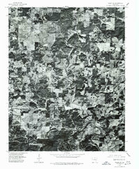
1976 Map of Salem SW
USGS Topo · Published 1977About this map
The Strawberry River carves through this portion of Fulton County, defining a landscape of varied agricultural clearings and dense timber. This orthophotoquad, produced from 1976 aerial imagery, reveals the rural spatial arrangement of the Ozarks during the late twentieth century. Tiny clusters of development at Bexar and Union represent the primary points of settlement, appearing as modest crossroads surrounded by a patchwork of small fields. Unlike traditional topographic maps, this imagery provides a direct look at the actual land cover and fence lines as they existed decades ago, capturing the specific texture of the hills and bottomlands before modern reforestation or land-use changes altered these small rural communities.
Find a feature on this map
3 named features on this map. Tap any name to fly to it.
Don’t see what you’re looking for? This feature index may not catch every label — zoom into the map to look around manually.
Map Details
Editions of this 1976 Salem SW Map
This is the sole edition of this map. No revisions or reprints were ever made.
Other maps of this area

1890 · Mountain Home
USGS Topo · 1:125,000

1891 · Mountain Home
USGS Topo · 1:125,000

1894 · Mountain Home
USGS Topo · 1:125,000

1945 · Harrison
USGS Topo · 1:250,000

1949 · Harrison
USGS Topo · 1:250,000

1950 · Salem
USGS Topo · 1:62,500

1951 · Salem
USGS Topo · 1:62,500

1951 · Melbourne
USGS Topo · 1:62,500

1954 · Harrison
USGS Topo · 1:250,000

1957 · Poplar Bluff
USGS Topo · 1:250,000