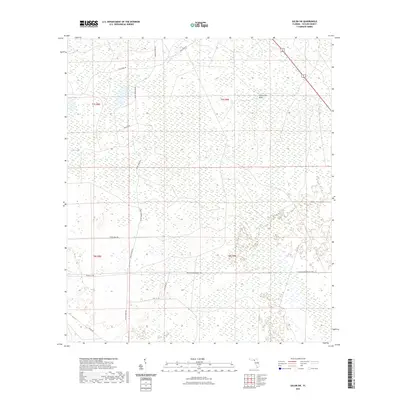
2021 Map of Salem SW
USGS Topo · Published 2021About this map
California Sinks and the water-carved depressions of Coker Sag define the interior of this coastal Florida landscape in Taylor County. The terrain is characterized by a dense network of forest roads and grades, indicating a region deeply tied to timber management and rural transit. Major thoroughfares such as Tennille Tpke and Tennille Crossroads Tpke intersect the southern half of the quadrangle, while the northern reaches are accessed via Fish Creek Rd and Andrew Wood Rd. The hydrology is dominated by Bevins Cr and numerous unnamed wetlands that permeate the flatwoods. Cultural landmarks include Salem Tower Rd, which points to the area's fire observation history, and local routes like Pickle Hole Rd and Tide City Rd that provide access to this isolated part of the Florida Panhandle.
Find a feature on this map
18 named features on this map. Tap any name to fly to it.
Don’t see what you’re looking for? This feature index may not catch every label — zoom into the map to look around manually.
Map Details
Editions of this 2021 Salem SW Map
This is the sole edition of this map. No revisions or reprints were ever made.
Other maps of this area

1954 · Clara
USGS Topo · 1:24,000

1954 · Salem SW
USGS Topo · 1:24,000

1954 · Jena
USGS Topo · 1:24,000

1954 · Cooks Hammock
USGS Topo · 1:24,000

1954 · Warrior Swamp
USGS Topo · 1:24,000

1954 · Salem
USGS Topo · 1:24,000

1954 · Steinhatchee
USGS Topo · 1:24,000

1954 · Keaton Beach
USGS Topo · 1:24,000

1954 · Crooked Point
USGS Topo · 1:24,000

1954 · Gainesville
USGS Topo · 1:250,000