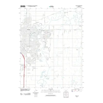
2009 Map of Salina
USGS Topo · Published 2009About this map
The city of Salina serves as the focal point of this 2009 survey, showcasing a dense grid of streets and residential developments that define the central Kansas landscape. The southern and eastern portions of the city are marked by significant landmarks including the Kansas Wesleyan University campus and several large memorial sites such as Mount Calvary Cemetery, Gypsum Hill Cemetery, and Memorial Park Cemetery. These features, clustered near the winding course of the Smoky Hill River, provide a detailed view of the community's civic and social infrastructure.
Find a feature on this map
46 named features on this map. Tap any name to fly to it.
Don’t see what you’re looking for? This feature index may not catch every label — zoom into the map to look around manually.
Map Details
Editions of this 2009 Salina Map
This is the sole edition of this map. No revisions or reprints were ever made.
Other maps of this area

1889 · Abilene
USGS Topo · 1:125,000

1892 · Salina
USGS Topo · 1:125,000

1894 · Abilene
USGS Topo · 1:125,000

1942 · Salina
USGS Topo · 1:125,000

1955 · Salina
USGS Topo · 1:24,000

1955 · Assaria
USGS Topo · 1:24,000

1955 · Salina SW
USGS Topo · 1:24,000

1955 · Trenton
USGS Topo · 1:24,000

1955 · Smolan
USGS Topo · 1:24,000

1955 · Niles
USGS Topo · 1:24,000