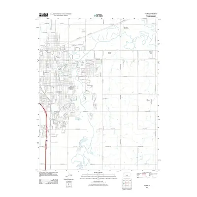
2012 Map of Salina
USGS Topo · Published 2012About this map
The Smoky Hill River meanders through the heart of Salina, Kansas, defining the city's early development and geography in this 2012 survey. To the north, the Saline River and Mulberry Cr join the river system, creating a landscape historically shaped by its waterways. The city's industrial and transportation roots are clearly visible through the Union Pacific Railroad corridor and its associated railroad yard.
Find a feature on this map
100 named features on this map. Tap any name to fly to it.
Don’t see what you’re looking for? This feature index may not catch every label — zoom into the map to look around manually.
Map Details
Editions of this 2012 Salina Map
This is the sole edition of this map. No revisions or reprints were ever made.
Other maps of this area

1889 · Abilene
USGS Topo · 1:125,000

1892 · Salina
USGS Topo · 1:125,000

1894 · Abilene
USGS Topo · 1:125,000

1942 · Salina
USGS Topo · 1:125,000

1955 · Salina
USGS Topo · 1:24,000

1955 · Assaria
USGS Topo · 1:24,000

1955 · Salina SW
USGS Topo · 1:24,000

1955 · Trenton
USGS Topo · 1:24,000

1955 · Smolan
USGS Topo · 1:24,000

1955 · Niles
USGS Topo · 1:24,000