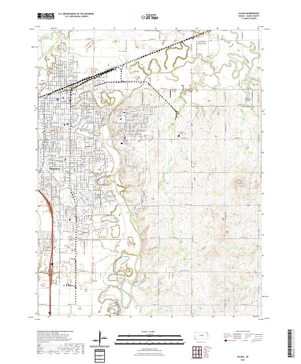
2022 Map of Salina
USGS Topo · Published 2022About this map
Salina serves as the central hub of this Kansas landscape, where the Smoky Hill River and the Saline River converge amid a grid of established neighborhoods and agricultural expanses. The civic heart of the city is anchored by the Saline County Courthouse and Kansas Wesleyan University, reflecting a legacy of regional governance and education. The surrounding terrain is marked by significant memorial sites, including Gypsum Hill Cem and Mount Calvary Cem, which provide valuable touchpoints for genealogical research. To the east, the elevation rises toward Iron Mound, contrasting with the alluvial plains shaped by Dry Cr and Mulberry Cr. Small-scale aviation facilities like Silers Plane Valley Airport and Jen-Bird Air Park dot the outskirts, illustrating the area's modern transportation network alongside traditional transit corridors like E Old US Highway 40.
Find a feature on this map
60 named features on this map. Tap any name to fly to it.
Don’t see what you’re looking for? This feature index may not catch every label — zoom into the map to look around manually.
Map Details
Editions of this 2022 Salina Map
This is the sole edition of this map. No revisions or reprints were ever made.
Other maps of this area

1889 · Abilene
USGS Topo · 1:125,000

1892 · Salina
USGS Topo · 1:125,000

1894 · Abilene
USGS Topo · 1:125,000

1942 · Salina
USGS Topo · 1:125,000

1955 · Salina
USGS Topo · 1:24,000

1955 · Assaria
USGS Topo · 1:24,000

1955 · Salina SW
USGS Topo · 1:24,000

1955 · Trenton
USGS Topo · 1:24,000

1955 · Smolan
USGS Topo · 1:24,000

1955 · Niles
USGS Topo · 1:24,000