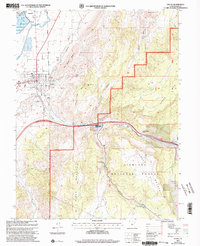
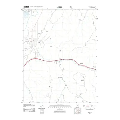
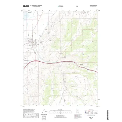
2001 Map of Salina
USGS Topo · Published 2003About this map
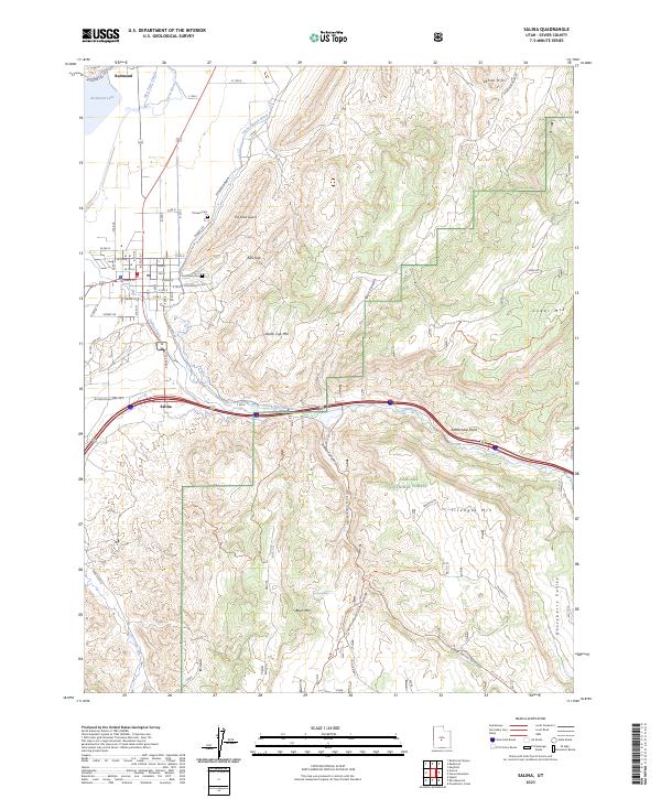
The Sevier River valley serves as the central artery for this 2001 revision of the Salina area, where irrigated agriculture meets the rising terrain of the Fishlake National Forest. The town of Salina is shown in detail, including the High Sch, Rodeo Ground, and civic landmarks such as Pioneer Cem and East Side Cem. This map reveals a landscape defined by water management and mineral extraction, featuring the Salina Canyon Dam and several irrigation structures along Salina Creek. The transition from the valley floor to the prominent Black Mountain and Triangle Mountain highlights the geographic isolation of the Sevier settlements. Resource use is evident in the presence of The Stone Quarry and various gravel pits, while the Salt Lake Meridian provides the primary surveying baseline for the township and range system.
Find a feature on this map
34 named features on this map. Tap any name to fly to it.
Don’t see what you’re looking for? This feature index may not catch every label — zoom into the map to look around manually.
Map Details
Editions of this 2001 Salina Map
This is the sole edition of this map. No revisions or reprints were ever made.
Historical Maps of Salina Through Time
11 maps found
1956 Salina
Sevier County, UT

1960 Salina
Sevier County, UT

1962 Salina
Sevier County, UT
1966 Salina
Sevier County, UT
1980 Salina
Sevier County, UT
2001 Salina
Sevier County, UT
2011 Salina
Sevier County, UT
2014 Salina
Sevier County, UT
2017 Salina
Sevier County, UT
2020 Salina
Sevier County, UT
2023 Salina
Sevier County, UT