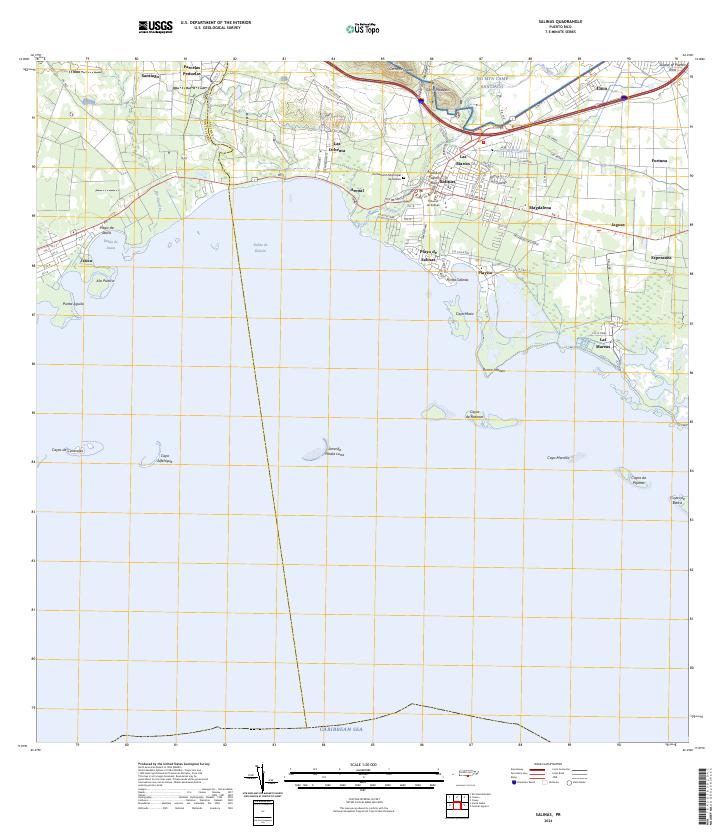
2024 Map of Salinas
USGS Topo · Published 2024About this map
The town of Salinas serves as the central hub of this coastal survey, where the Rio Nigua meets the Caribbean shoreline. The landscape is defined by its maritime geography, from the deep indent of the Bahía de Rincón to the numerous small islands and reefs like Cayo Mata and Arrecife Media Luna. Military and civic infrastructure is prominent, notably the extensive grounds of NG MTA Camp Santiago to the north and the Tribunal de Salinas within the municipal center. Coastal settlements such as Playa de Salinas and Las Mareas illustrate the region's enduring connection to the sea. Inland, the terrain rises toward Cerro Respaldo and Cerro Modesto, while the Canal de Patillas cuts across the eastern plains near Fortuna and Magdalena, tracing the historical water management patterns of the island's southern coast.
Find a feature on this map
57 named features on this map. Tap any name to fly to it.
Don’t see what you’re looking for? This feature index may not catch every label — zoom into the map to look around manually.
Map Details
Editions of this 2024 Salinas Map
This is the sole edition of this map. No revisions or reprints were ever made.
Other maps of this area

1944 · Santa Isabel
USGS Topo · 1:30,000

1945 · Rio Descalabrado
USGS Topo · 1:30,000

1945 · Central Aguirre
USGS Topo · 1:30,000

1945 · Salinas
USGS Topo · 1:30,000

1946 · Coamo
USGS Topo · 1:30,000

1946 · Cayey
USGS Topo · 1:30,000
1947 · Rio Descalabrado SE
USGS Topo · 1:10,000

1947 · Cayey SO
USGS Topo · 1:10,000
1947 · Salinas NE
USGS Topo · 1:10,000
1947 · Central Aquirre SO
USGS Topo · 1:10,000
Featured Places
- Salinas
- Urb. Brisas del Everlymar, Salinas
- Urb. Vistas de Salinas, Salinas
- Corales del Mar, Salinas
- Villasol, Salinas