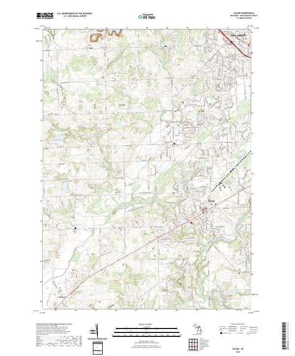
2023 Map of Saline
USGS Topo · Published 2023About this map
Saline and the southern fringes of Ann Arbor define the landscape of this Washtenaw County survey. The Saline River winds through the central and western portions of the quadrangle, where the terrain is marked by a network of drainage ditches such as Wood Outlet Drain, Pittsfield Number Five Drain, and Koch Warner Drain. These watercourses reflect the agricultural heritage of the region, facilitating land use across the fertile township lines. Genealogists will find a high concentration of burial sites, including the prominent Oakwood Cem in town and smaller rural yards like Judd Cem and Rosier Cem. Transportation is anchored by the historic corridors of W Michigan Ave and E Michigan Ave, while the Saline Airport marks the transition toward modern infrastructure south of the city center. Smaller water bodies like Deppmann Lake and Birkle Lake are scattered throughout the northern sections.
Find a feature on this map
37 named features on this map. Tap any name to fly to it.
Don’t see what you’re looking for? This feature index may not catch every label — zoom into the map to look around manually.
Map Details
Editions of this 2023 Saline Map
This is the sole edition of this map. No revisions or reprints were ever made.
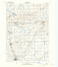
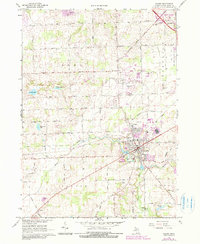
Historical Maps of York Charter Township Through Time
3 maps found