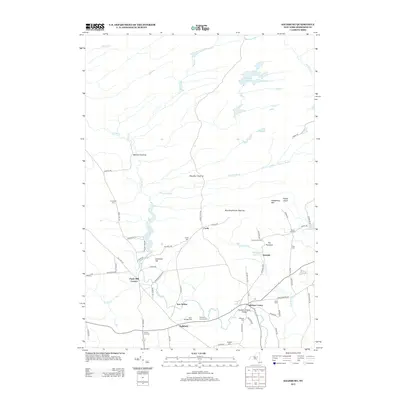
2013 Map of Salisbury
USGS Topo · Published 2013About this map
Salisbury and its surrounding hamlets occupy a landscape shaped by rural industry and historic clearings along the southern edge of the Adirondacks. Named clearings like Mexico Clearing, Murphy Clearing, and Boardinghouse Clearing point to a history of forest management and early settlement patterns north of the main village centers. The importance of local water power and industrial history is evident at Paper Mill Corners and the multiple reservoirs, including Klondike Reservoir and Dolgeville Reservoir, that manage the flow of Spruce Cr. Genealogists will find a significant concentration of burial sites, ranging from the Salisbury Rural Cem to smaller family or community plots like Comstock Cem and Tuttle Cem. The map traces a network of early routes such as Military Rd and Mexico Rd, connecting disparate corners like Ives Hollow and Wood Corners to the central hub at Salisbury Center.
Find a feature on this map
70 named features on this map. Tap any name to fly to it.
Don’t see what you’re looking for? This feature index may not catch every label — zoom into the map to look around manually.
Map Details
Editions of this 2013 Salisbury Map
This is the sole edition of this map. No revisions or reprints were ever made.
Other maps of this area

1900 · Little Falls
USGS Topo · 1:62,500

1900 · Wilmurt
USGS Topo · 1:62,500

1901 · Lassellsville
USGS Topo · 1:62,500

1902 · Wilmurt
USGS Topo · 1:62,500

1903 · Lassellsville
USGS Topo · 1:62,500

1903 · Little Falls
USGS Topo · 1:62,500

1904 · Piseco Lake
USGS Topo · 1:62,500

1906 · Piseco Lake
USGS Topo · 1:62,500

1908 · Piseco Lake
USGS Topo · 1:62,500

1939 · Little Falls
USGS Topo · 1:62,500