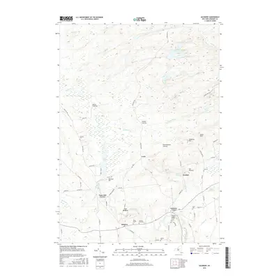
2016 Map of Salisbury
USGS Topo · Published 2016About this map
The town of Salisbury and its surrounding hamlets occupy this landscape on the southern edge of the Adirondacks. Historically significant settlements such as Salisbury Center, Ives Hollow, and Irondale are mapped alongside a high concentration of burial grounds, including Salisbury Rural Cem and Saint Bridget Cem, which provide valuable location data for genealogists. The area is characterized by high terrain like Hedgehog Mtn and The Pinnacle, with several upland clearings such as Mexico Clearing and Murphy Clearing suggesting a history of specialized forest use or high-elevation agriculture.
Find a feature on this map
63 named features on this map. Tap any name to fly to it.
Don’t see what you’re looking for? This feature index may not catch every label — zoom into the map to look around manually.
Map Details
Editions of this 2016 Salisbury Map
This is the sole edition of this map. No revisions or reprints were ever made.
Other maps of this area

1900 · Little Falls
USGS Topo · 1:62,500

1900 · Wilmurt
USGS Topo · 1:62,500

1901 · Lassellsville
USGS Topo · 1:62,500

1902 · Wilmurt
USGS Topo · 1:62,500

1903 · Lassellsville
USGS Topo · 1:62,500

1903 · Little Falls
USGS Topo · 1:62,500

1904 · Piseco Lake
USGS Topo · 1:62,500

1906 · Piseco Lake
USGS Topo · 1:62,500

1908 · Piseco Lake
USGS Topo · 1:62,500

1939 · Little Falls
USGS Topo · 1:62,500