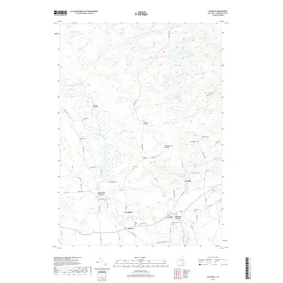
2019 Map of Salisbury
USGS Topo · Published 2019About this map
Spruce Creek flows southward through a landscape of clearings and small hamlets, anchoring the geography of Herkimer County. The settlement at Salisbury Center and the neighboring village of Salisbury serve as the primary hubs, where the Salisbury Center Bridge and numerous burial grounds like Saint Bridget Cem and Salisbury Cem provide significant points of interest for local historians and genealogists. The topography is defined by distinct elevations such as Hedgehog Mtn and The Pinnacle, which overlook the Dolgeville Reservoir. Historic land use is evident in the naming of remote areas like Mexico Clearing, Murphy Clearing, and Boardinghouse Clearing, suggesting a legacy of timbering or early agricultural pockets in the Adirondack foothills. Significant local roads, including Military Rd and Jerseyfield Rd, connect these scattered clearings to more established intersections like Paper Mill Corners and Ives Hollow.
Find a feature on this map
64 named features on this map. Tap any name to fly to it.
Don’t see what you’re looking for? This feature index may not catch every label — zoom into the map to look around manually.
Map Details
Editions of this 2019 Salisbury Map
This is the sole edition of this map. No revisions or reprints were ever made.
Other maps of this area

1900 · Little Falls
USGS Topo · 1:62,500

1900 · Wilmurt
USGS Topo · 1:62,500

1901 · Lassellsville
USGS Topo · 1:62,500

1902 · Wilmurt
USGS Topo · 1:62,500

1903 · Lassellsville
USGS Topo · 1:62,500

1903 · Little Falls
USGS Topo · 1:62,500

1904 · Piseco Lake
USGS Topo · 1:62,500

1906 · Piseco Lake
USGS Topo · 1:62,500

1908 · Piseco Lake
USGS Topo · 1:62,500

1939 · Little Falls
USGS Topo · 1:62,500