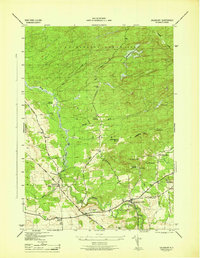
1946 Map of Salisbury
USGS Topo · Published 1946About this map
The Adirondack State Park boundary cuts through this Herkimer County landscape, where the southern forest gives way to the agricultural and early industrial settlements of Salisbury. The mapping, completed just after the war years, reveals a community organized around water power and timber, evidenced by place names like Paper Mill Corners and several forest openings including Mexico Clearing and Boardinghouse Clearing.
Find a feature on this map
46 named features on this map. Tap any name to fly to it.
Don’t see what you’re looking for? This feature index may not catch every label — zoom into the map to look around manually.
Map Details
Editions of this 1946 Salisbury Map
This is the sole edition of this map. No revisions or reprints were ever made.
Other maps of this area

1900 · Little Falls
USGS Topo · 1:62,500

1900 · Wilmurt
USGS Topo · 1:62,500

1901 · Lassellsville
USGS Topo · 1:62,500

1902 · Wilmurt
USGS Topo · 1:62,500

1903 · Lassellsville
USGS Topo · 1:62,500

1903 · Little Falls
USGS Topo · 1:62,500

1904 · Piseco Lake
USGS Topo · 1:62,500

1906 · Piseco Lake
USGS Topo · 1:62,500

1908 · Piseco Lake
USGS Topo · 1:62,500

1939 · Little Falls
USGS Topo · 1:62,500