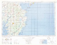
1957 Map of Salisbury
USGS Topo · Published 1957About this map
The Delmarva Peninsula in the mid-1950s is defined here by its intricate shoreline and established rail corridors. The Pennsylvania and Baltimore and Eastern railroads tie together the primary agricultural and industrial hubs of Salisbury, Georgetown, and Seaford. Along the coast, the era's military and maritime significance is evident through installations like the Fort Miles Military Reservation and the Cape May Naval Air Station. Aviation infrastructure of the day includes the Ocean City Seaplane Base and Midway Airpark, serving a coastal landscape still largely defined by its natural islands and marshes. From the Fenwick Island Lighthouse down to Assateague Island, the map documents a network of small settlements and inland waterways, including the Nanticoke River and Pocomoke River, which shaped the early economy and transport of the Eastern Shore.
Find a feature on this map
155 named features on this map. Tap any name to fly to it.
Don’t see what you’re looking for? This feature index may not catch every label — zoom into the map to look around manually.
Map Details
Editions of this 1957 Salisbury Map
This is the sole edition of this map. No revisions or reprints were ever made.
Other maps of this area

1884 · Sea Isle
USGS Topo · 1:62,500

1888 · Cape May
USGS Topo · 1:62,500

1888 · Dennisville
USGS Topo · 1:62,500

1888 · Sea Isle
USGS Topo · 1:62,500

1890 · Maurice Cove
USGS Topo · 1:62,500

1891 · Maurice Cove
USGS Topo · 1:62,500

1893 · Cape May
USGS Topo · 1:62,500

1894 · Dennisville
USGS Topo · 1:62,500

1894 · Sea Isle
USGS Topo · 1:62,500

1898 · Choptank
USGS Topo · 1:125,000