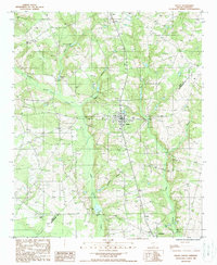
1988 Map of Salley
USGS Topo · Published 1988About this map
The town of Salley serves as the central hub of this South Carolina landscape during the 1980s, situated near the border of Aiken Co and Orangeburg Co. The terrain is characterized by a dense network of watercourses and wetlands, including the extensive Dean Swamp Creek and smaller tributaries like Jordon Creek, Abrams Creek, and Bratcher Branch. To the north and south, the smaller settlements of Perry and Springfield bookend the quadrangle, connected by a maturing road system that traverses the low-lying areas. Numerous unnamed cemeteries are scattered across the rural countryside, offering points of interest for genealogists and local historians. Industrial and utility infrastructure is evident through the presence of a Sand Pit near the northern boundary, as well as a Lookout Tower and Radio Tower, reflecting the land's management for both natural resources and communications.
Find a feature on this map
17 named features on this map. Tap any name to fly to it.
Don’t see what you’re looking for? This feature index may not catch every label — zoom into the map to look around manually.
Map Details
Editions of this 1988 Salley Map
This is the sole edition of this map. No revisions or reprints were ever made.
Other maps of this area

1919 · Bamberg
USGS Topo · 1:48,000

1920 · Bamberg
USGS Topo · 1:62,500

1923 · Williston
USGS Topo · 1:48,000

1927 · Williston
USGS Topo · 1:62,500

1943 · Bamberg
USGS Topo · 1:62,500

1943 · Williston
USGS Topo · 1:62,500

1944 · Seivern
USGS Topo · 1:62,500

1946 · Woodford
USGS Topo · 1:62,500

1954 · Augusta
USGS Topo · 1:250,000

1957 · Augusta
USGS Topo · 1:250,000