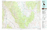
1981 Map of Salmon
USGS Topo · Published 1982About this map
The Continental Divide serves as the jagged spine of this 1980s landscape, marking the high-altitude boundary between Idaho and Montana. To the west, the Salmon River and Lemhi River converge near the community of Salmon, while to the east, the headwaters of the Big Hole River wind through Horse Prairie. This region is defined by its massive mountain systems, including the Beaverhead Mountains and the Bitterroot Range, which have historically constrained travel and settlement to the valley floors.
Find a feature on this map
30 named features on this map. Tap any name to fly to it.
Don’t see what you’re looking for? This feature index may not catch every label — zoom into the map to look around manually.
Map Details
Editions of this 1981 Salmon Map
This is the sole edition of this map. No revisions or reprints were ever made.
Other maps of this area

1893 · Dillon
USGS Topo · 1:250,000

1950 · Salmon
USGS Topo · 1:62,500

1950 · Leesburg
USGS Topo · 1:62,500

1951 · Leesburg
USGS Topo · 1:62,500

1951 · Salmon
USGS Topo · 1:62,500

1952 · Bannack
USGS Topo · 1:24,000

1952 · Torrey Mountain
USGS Topo · 1:24,000

1952 · Eli Spring
USGS Topo · 1:24,000

1952 · Ermont
USGS Topo · 1:24,000

1955 · Dubois
USGS Topo · 1:250,000