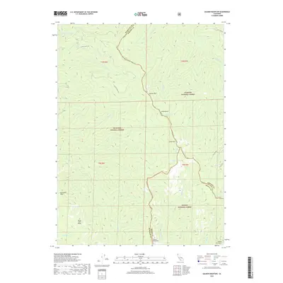
2018 Map of Salmon Mountain
USGS Topo · Published 2018About this map
Salmon Mtn and the surrounding high country of the Salmon Mountains stand at the intersection of three major national forests in this 2018 survey. The map details a complex network of ridgelines and water sources, including the Salmon Summit Trl which traverses the rugged border between the Six Rivers National Forest and Klamath National Forest. Named landmarks like Whiteys Peak, Indian Rocks, and Devils Backbone define the topography, while high-elevation water bodies such as Red Cap Lake and Nordheimer Lake are primary features in the drainage basins for Nordheimer Cr and Red Cap Cr. This modern topographic study identifies the precise boundaries between Humboldt, Siskiyou, and Trinity counties, offering a clear view of the wilderness as it was managed in the early 21st century.
Find a feature on this map
33 named features on this map. Tap any name to fly to it.
Don’t see what you’re looking for? This feature index may not catch every label — zoom into the map to look around manually.
Map Details
Editions of this 2018 Salmon Mountain Map
This is the sole edition of this map. No revisions or reprints were ever made.
Other maps of this area

1925 · Hoopa
USGS Topo · 1:125,000

1948 · Weed
USGS Topo · 1:250,000

1950 · Weed
USGS Topo · 1:250,000

1952 · Hoopa
USGS Topo · 1:62,500

1952 · Orleans
USGS Topo · 1:62,500

1955 · Salmon Mtn
USGS Topo · 1:62,500

1955 · Forks of Salmon
USGS Topo · 1:62,500

1958 · Weed
USGS Topo · 1:250,000

1963 · Weed
USGS Topo · 1:250,000

1974 · Orleans Mtn.
USGS Topo · 1:24,000