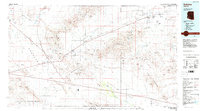
1984 Map of Salome
USGS Topo · Published 1984About this map
The desert landscape of western Arizona is defined by the sweeping McMullen Valley and the prominent Harquahala Mountains in this mid-1980s topographical survey. The Atchison Topeka and Santa Fe railroad corridor serves as the primary axis for regional settlement, connecting the towns of Salome, Wenden, and Aguila. This transit-oriented development patterns follows the valley floor, tucked between the high ridges of the Harcuvar Mountains and the Little Harquahala Mountains.
Find a feature on this map
56 named features on this map. Tap any name to fly to it.
Don’t see what you’re looking for? This feature index may not catch every label — zoom into the map to look around manually.
Map Details
Editions of this 1984 Salome Map
This is the sole edition of this map. No revisions or reprints were ever made.
Other maps of this area

1887 · Prescott
USGS Topo · 1:250,000

1892 · Prescott
USGS Topo · 1:250,000

1903 · Congress
USGS Topo · 1:125,000

1904 · Congress
USGS Topo · 1:125,000

1911 · Parker
USGS Topo · 1:125,000

1923 · Signal
USGS Topo · 1:250,000

1930 · Linskey
USGS Topo · 1:62,500

1942 · Signal
USGS Topo · 1:250,000

1942 · Blythe
USGS Topo · 1:250,000

1942 · Vicksburg
USGS Topo · 1:250,000