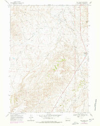
1968 Map of Salt Creek
USGS Topo · Published 1978About this map
The Salt Creek Oil Field dominates this 1960s Wyoming landscape, revealing an intensive industrial network of pipelines, tank batteries, and numerous Drill Holes. This area was a cornerstone of American energy production, as evidenced by the inclusion of the Naval Petroleum Reserve No 3 (Teapot Dome) in the southeast. While industry is the primary theme, the map also documents small human outposts like Trigood Camp and the settlement of Salt Creek.
Find a feature on this map
17 named features on this map. Tap any name to fly to it.
Don’t see what you’re looking for? This feature index may not catch every label — zoom into the map to look around manually.
Map Details
Editions of this 1968 Salt Creek Map
2 editions found
Other maps of this area

1955 · Arminto
USGS Topo · 1:250,000

1958 · Arminto
USGS Topo · 1:250,000

1959 · Edgerton
USGS Topo · 1:62,500

1959 · Ormsby Draw
USGS Topo · 1:62,500

1962 · Arminto
USGS Topo · 1:250,000

1968 · Big Gulch
USGS Topo · 1:24,000

1968 · Midwest
USGS Topo · 1:24,000

1968 · Salt Creek
USGS Topo · 1:24,000
1968 · Statzer Point
USGS Topo · 1:24,000
1968 · Teapot Rock
USGS Topo · 1:24,000