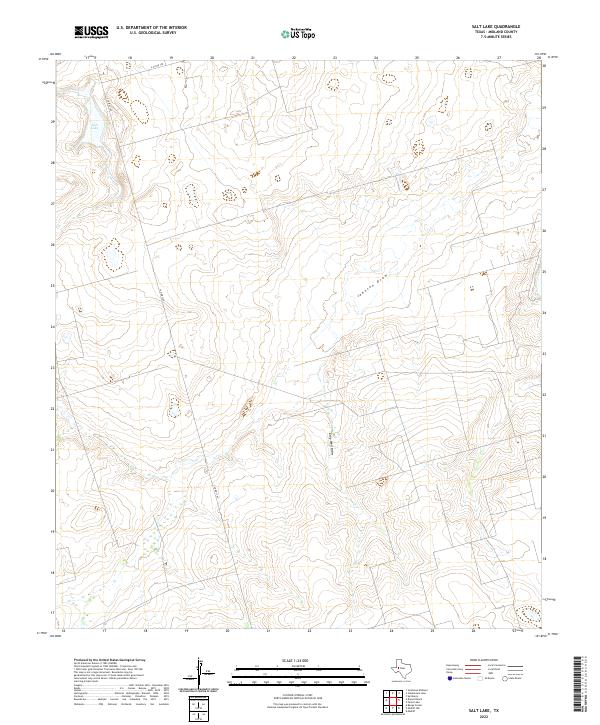
2022 Map of Salt Lake
USGS Topo · Published 2022About this map
Salt Lake and the subtle depressions of the Llano Estacado define this portion of Midland County. The landscape is characterized by intermittent drainage patterns and ephemeral water features, most notably Johnson Draw and Gray Well Draw, which cut through the arid terrain. Unlike more densely settled regions, this area maintains a low-density rural character, with infrastructure limited to a few arterial routes such as E Co Rd 190 and S Co Rd 1160. These roads represent the primary corridors for ranching and local transit in a landscape where water and elevation dictate the location of improvements and property boundaries. The survey provides a clear view of the natural topography and the sparse human footprint in the Texas South Plains during the early 2020s.
Find a feature on this map
5 named features on this map. Tap any name to fly to it.
Don’t see what you’re looking for? This feature index may not catch every label — zoom into the map to look around manually.
Map Details
Editions of this 2022 Salt Lake Map
This is the sole edition of this map. No revisions or reprints were ever made.
Other maps of this area

1954 · Pecos
USGS Topo · 1:250,000

1954 · San Angelo
USGS Topo · 1:250,000

1957 · Pecos
USGS Topo · 1:250,000

1958 · San Angelo
USGS Topo · 1:250,000

1964 · Bryant Ranch
USGS Topo · 1:24,000

1965 · San Angelo
USGS Topo · 1:250,000

1965 · Southeast Midland
USGS Topo · 1:24,000

1965 · Spraberry
USGS Topo · 1:24,000

1965 · Salt Lake
USGS Topo · 1:24,000

1965 · Pecks Lake
USGS Topo · 1:24,000