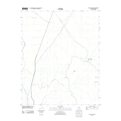
2012 Map of Saltdale NW
USGS Topo · Published 2012About this map
Red Rock Canyon State Park anchors the southwestern portion of this Kern County survey, where the arid landscape is defined by complex drainage systems and isolated mining-era outposts. The map documents a rugged interior geography shaped by Little Dixie Wash and the prominent elevations of the Red Buttes. Human intervention in this desert environment is marked by significant engineering and habitation sites, including the Los Angeles Aqueduct and the famous Burro Schmidts Tunnel. Local history is preserved through named locations such as Bickel Camp, Cudahy Camp, and Schmidt Camp, which are linked by a network of primitive routes like Horse Canyon Rd and Burro-Schmidt Tunnel Rd. These features reflect the region's legacy of prospecting and resource management, tracing the paths through Bonanza Gulch and Boulder Gulch that once supported remote desert living and industrial ambition.
Find a feature on this map
15 named features on this map. Tap any name to fly to it.
Don’t see what you’re looking for? This feature index may not catch every label — zoom into the map to look around manually.
Map Details
Editions of this 2012 Saltdale NW Map
This is the sole edition of this map. No revisions or reprints were ever made.
Other maps of this area

1906 · Kernville
USGS Topo · 1:125,000

1908 · Kernville
USGS Topo · 1:125,000

1915 · Searles Lake
USGS Topo · 1:250,000

1915 · Mojave
USGS Topo · 1:125,000

1943 · Inyokern
USGS Topo · 1:62,500

1943 · Cross Mountain
USGS Topo · 1:62,500

1943 · Saltdale
USGS Topo · 1:62,500

1943 · Onyx
USGS Topo · 1:62,500

1947 · Trona
USGS Topo · 1:250,000

1948 · Trona
USGS Topo · 1:250,000