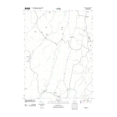
2010 Map of Saltillo
USGS Topo · Published 2010About this map
Grave Mountain and the high point at Round Knob dominate the rugged geography of this Huntingdon County terrain, where small settlements are tucked into valleys carved by Great Trough Creek and Roaring Run. The map records a series of rural communities along the winding road network, including the borough of Saltillo, the village of Robertsdale, and smaller hamlets like Joller, Kimmel, and Cooks. Local genealogy is well-documented through a high density of burial grounds such as the Edwards Family Cemetery and the Robertsdale Italian Cemetery, reflecting the diverse heritage of this coal-country region. To the south, the landscape opens into Shore Valley near the settlement of Waterfall, while the Rock Hill Lookout Tower stands as a prominent landmark overlooking the southern reaches of the quadrangle.
Find a feature on this map
53 named features on this map. Tap any name to fly to it.
Don’t see what you’re looking for? This feature index may not catch every label — zoom into the map to look around manually.
Map Details
Editions of this 2010 Saltillo Map
This is the sole edition of this map. No revisions or reprints were ever made.
Other maps of this area

1901 · Huntingdon
USGS Topo · 1:62,500

1904 · Huntingdon
USGS Topo · 1:62,500

1922 · Mt Union
USGS Topo · 1:48,000

1924 · Mt. Union
USGS Topo · 1:62,500

1930 · Broad Top
USGS Topo · 1:62,500

1933 · Broad Top
USGS Topo · 1:62,500

1939 · Orbisonia
USGS Topo · 1:62,500

1940 · Orbisonia
USGS Topo · 1:62,500

1944 · Orbisonia
USGS Topo · 1:62,500

1944 · Mt. Union
USGS Topo · 1:62,500