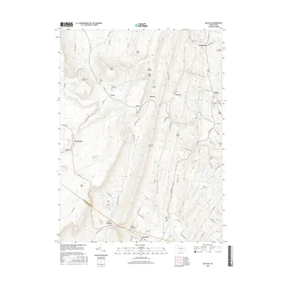
2016 Map of Saltillo
USGS Topo · Published 2016About this map
Jacks Mountain and Sideling Hill define the linear, ridge-and-valley corridor of this central Pennsylvania landscape, where small hamlets like Saltillo and Robertsdale anchor local history. The map preserves the locations of several burial grounds, including the Robertsdale Italian Cem and the Edwards Family Cem, which offer significant genealogical markers for those tracing local heritage. Roads such as Cooks Rd and Gravedigger Dr connect these communities across the difficult terrain of Poplar Hollow and Coles Valley. The intersection of Huntingdon and Fulton counties is visible near New Grenada, a settlement positioned at the confluence of several rural routes including Wells Valley Rd and Summers Rd. Numerous watercourses like Great Trough Cr and Sideling Hill Creek drain the valleys, illustrating the natural drainage patterns that historically dictated the placement of mountain passes and settlements.
Find a feature on this map
79 named features on this map. Tap any name to fly to it.
Don’t see what you’re looking for? This feature index may not catch every label — zoom into the map to look around manually.
Map Details
Editions of this 2016 Saltillo Map
This is the sole edition of this map. No revisions or reprints were ever made.
Other maps of this area

1901 · Huntingdon
USGS Topo · 1:62,500

1904 · Huntingdon
USGS Topo · 1:62,500

1922 · Mt Union
USGS Topo · 1:48,000

1924 · Mt. Union
USGS Topo · 1:62,500

1930 · Broad Top
USGS Topo · 1:62,500

1933 · Broad Top
USGS Topo · 1:62,500

1939 · Orbisonia
USGS Topo · 1:62,500

1940 · Orbisonia
USGS Topo · 1:62,500

1944 · Orbisonia
USGS Topo · 1:62,500

1944 · Mt. Union
USGS Topo · 1:62,500