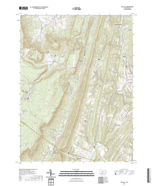
2023 Map of Saltillo
USGS Topo · Published 2023About this map
Saltillo and Robertsdale anchor this study of the varied ridge-and-valley landscape across the Huntingdon and Fulton county line. The terrain is defined by the steep rises of Sideling Hill and Rocky Ridge, which hem in narrow agricultural corridors like Hares Valley and Coles Valley. The map reveals a dense network of local cemeteries, such as the Edwards Family Cem and the Robertsdale Italian Cem, providing invaluable data for genealogists tracing the legacy of these small upland communities. Settlement patterns follow the hollows and gaps, with places like Joller, Kimmel, and Cooks situated along winding routes like the Old Plank Rd. Several water bodies, including Great Trough Creek and Roaring Run, drain the valleys, illustrating the natural drainage systems that once powered local milling and farming operations in this part of Pennsylvania.
Find a feature on this map
86 named features on this map. Tap any name to fly to it.
Don’t see what you’re looking for? This feature index may not catch every label — zoom into the map to look around manually.
Map Details
Editions of this 2023 Saltillo Map
This is the sole edition of this map. No revisions or reprints were ever made.
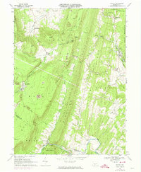
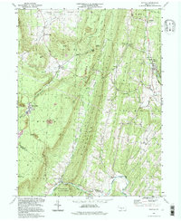
Historical Maps of Kimmel Through Time
3 maps found