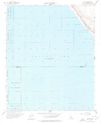
1956 Map of Salton
USGS Topo · Published 1977About this map
Salton Sea dominates this mid-century topographic record, capturing the shoreline during a period when its elevation was documented at 235 feet below sea level. The landscape is a stark desert basin, where the Torres Martinez Indian Reservation spans large tracts of the northwestern and southern portions of the map. Human infrastructure is concentrated along the narrow strip of land between the water and the rising terrain to the northeast, where the Southern Pacific railroad tracks parallel the coast near the settlement of Salton. This area serves as a transit corridor, marked by a Jeep Trail, a local Well, and the designated boundaries of the Salton Sea State Park. The map also delineates the border between Riverside and Imperial Counties, providing a clear view of how these administrative lines intersect the low-lying basin floor and its industrial features like the shoreline Gravel Pits.
Find a feature on this map
10 named features on this map. Tap any name to fly to it.
Don’t see what you’re looking for? This feature index may not catch every label — zoom into the map to look around manually.
Map Details
Editions of this 1956 Salton Map
3 editions found
Other maps of this area

1904 · Indio
USGS Topo · 1:125,000

1931 · Vallecito
USGS Topo · 1:125,000

1940 · Cottonwood Spring
USGS Topo · 1:62,500

1940 · Durmid
USGS Topo · 1:62,500

1941 · Coachella
USGS Topo · 1:62,500

1942 · Agua Dulce
USGS Topo · 1:62,500

1943 · Vallecito
USGS Topo · 1:125,000

1943 · Coachella
USGS Topo · 1:62,500

1944 · Agua Dulce
USGS Topo · 1:62,500

1944 · Cottonwood Spring
USGS Topo · 1:62,500