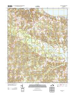
2013 Map of Saluda
USGS Topo · Published 2013About this map
Saluda serves as a central hub in Middlesex County, positioned where the Tidewater Trl meets US-17 Bus. The landscape is defined by the winding Piankatank River and several extensive marsh systems, including Courthouse Swamp and My Ladys Swamp, which historically dictated the placement of roads and landings. To the north, the terrain reaches the banks of the Rappahannock River at Burhans Wharf near the settlement of Cooper.
Find a feature on this map
48 named features on this map. Tap any name to fly to it.
Don’t see what you’re looking for? This feature index may not catch every label — zoom into the map to look around manually.
Map Details
Editions of this 2013 Saluda Map
This is the sole edition of this map. No revisions or reprints were ever made.
Other maps of this area

1906 · Williamsburg
USGS Topo · 1:62,500

1916 · Kilmarnock
USGS Topo · 1:48,000

1916 · Mathews
USGS Topo · 1:62,500

1917 · Urbanna
USGS Topo · 1:62,500

1917 · Kilmarnock
USGS Topo · 1:62,500

1917 · Mathews
USGS Topo · 1:62,500

1942 · Kilmarnock
USGS Topo · 1:62,500

1943 · Richmond
USGS Topo · 1:250,000
1946 · Urbanna
USGS Topo · 1:24,000

1948 · Ware Neck
USGS Topo · 1:24,000