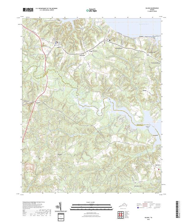
2022 Map of Saluda
USGS Topo · Published 2022About this map
The Middlesex County Courthouse stands as the civic heart of the region in Saluda, a settlement situated on the high ground between two major Virginia waterways. This coastal plain landscape is defined by the proximity of the Rappahannock River to the north and the Piankatank River to the south, with tidal marshes and finger-like inlets creating a complex drainage network. Local genealogy is anchored by established sites like Antioch Baptist Church Cem and Christ Church Cem, while the interior is marked by distinctive place names such as Nohead Bottom, Hornets Nest, and Cooks Corner. The map reveals a transition from the structured street plan of the Rappahannock Community College Glenns Campus to the expansive wetlands of Dragon Swamp and Pratts Mill Swamp, illustrating how the Chesapeake's hydrology continues to dictate the patterns of human settlement and transport.
Find a feature on this map
122 named features on this map. Tap any name to fly to it.
Don’t see what you’re looking for? This feature index may not catch every label — zoom into the map to look around manually.
Map Details
Editions of this 2022 Saluda Map
This is the sole edition of this map. No revisions or reprints were ever made.
Other maps of this area

1906 · Williamsburg
USGS Topo · 1:62,500

1916 · Kilmarnock
USGS Topo · 1:48,000

1916 · Mathews
USGS Topo · 1:62,500

1917 · Urbanna
USGS Topo · 1:62,500

1917 · Kilmarnock
USGS Topo · 1:62,500

1917 · Mathews
USGS Topo · 1:62,500

1942 · Kilmarnock
USGS Topo · 1:62,500

1943 · Richmond
USGS Topo · 1:250,000
1946 · Urbanna
USGS Topo · 1:24,000

1948 · Ware Neck
USGS Topo · 1:24,000