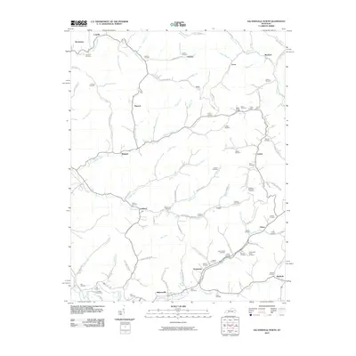
2010 Map of Salyersville North
USGS Topo · Published 2010About this map
Salyersville anchors the southern edge of this landscape, where the Licking River and its numerous forks carve through the terrain of Magoffin County. This 2010 survey highlights a deeply entrenched settlement pattern defined by creek-bottom communities like Lickburg, Plutarch, and Minefork. The density of family burial grounds is particularly notable, with the Ham Conley Cemetery, Christopher Gullett Cemetery, and Tackett Memorial Cemetery serving as vital landmarks for genealogists and local historians. The area's water network is intricately detailed, featuring the Rockhouse Creek in the north and the sprawling Big Mine Fork to the east. These waterways, alongside roads like Stingy Fork Rd and Buffalo Creek Rd, illustrate the historical reliance on narrow valleys for both transportation and community development in this part of Kentucky.
Find a feature on this map
110 named features on this map. Tap any name to fly to it.
Don’t see what you’re looking for? This feature index may not catch every label — zoom into the map to look around manually.
Map Details
Editions of this 2010 Salyersville North Map
This is the sole edition of this map. No revisions or reprints were ever made.
Other maps of this area

1886 · Prestonsburg
USGS Topo · 1:125,000

1889 · Salyersville
USGS Topo · 1:125,000

1891 · Salyersville
USGS Topo · 1:125,000

1892 · Prestonsburg
USGS Topo · 1:125,000

1899 · Salyersville
USGS Topo · 1:125,000

1915 · Paintsville
USGS Topo · 1:48,000

1915 · Prestonsburg
USGS Topo · 1:62,500

1917 · Paintsville
USGS Topo · 1:62,500

1918 · Prestonsburg
USGS Topo · 1:62,500

1950 · Lenox
USGS Topo · 1:24,000