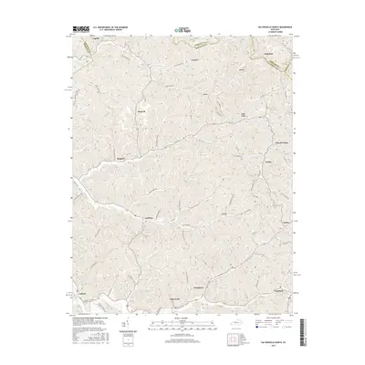
2016 Map of Salyersville North
USGS Topo · Published 2016About this map
Salyersville serves as the focal point for this survey of the Licking River's upper reaches in Magoffin County. The landscape is defined by its deep hollows and narrow ridge-top roads, reflecting the traditional Appalachian settlement patterns where communities formed along watercourses and gap crossings. This 2016 data illustrates a network of scattered hamlets like Lickburg, Maggard, and Falcon connected by namesake mountain roads such as Phipps Fork Rd and Buck Lick Fork Rd. Significant for genealogists and local historians, the map documents numerous rural family-named locations and connectors including Russell Cemetery Rd and Vanzel Borders Rd, alongside industrial and agricultural outposts like Minefork and Gifford.
Find a feature on this map
59 named features on this map. Tap any name to fly to it.
Don’t see what you’re looking for? This feature index may not catch every label — zoom into the map to look around manually.
Map Details
Editions of this 2016 Salyersville North Map
This is the sole edition of this map. No revisions or reprints were ever made.
Other maps of this area

1886 · Prestonsburg
USGS Topo · 1:125,000

1889 · Salyersville
USGS Topo · 1:125,000

1891 · Salyersville
USGS Topo · 1:125,000

1892 · Prestonsburg
USGS Topo · 1:125,000

1899 · Salyersville
USGS Topo · 1:125,000

1915 · Paintsville
USGS Topo · 1:48,000

1915 · Prestonsburg
USGS Topo · 1:62,500

1917 · Paintsville
USGS Topo · 1:62,500

1918 · Prestonsburg
USGS Topo · 1:62,500

1950 · Lenox
USGS Topo · 1:24,000