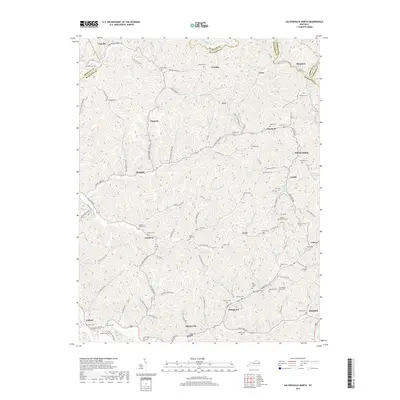
2019 Map of Salyersville North
USGS Topo · Published 2019About this map
The Licking River and its complex network of tributaries like State Road Fork and Horsepen Fork define the settlement patterns of this Magoffin County landscape. In the southern portion of the map, Salyersville serves as the primary hub, with residential clusters following the narrow valley floors along Maple St and Falcon Rd. This 2019 survey documents a deeply ingrained family history through its numerous hilltop and hillside cemeteries, such as Tackett Memorial Cem and the Christopher Gullett Cem. Smaller communities like Wheelersburg, Lickburg, and Falcon are interconnected by winding secondary roads that trace the natural contours of the Cumberland Plateau. The distribution of sites like Stringtown and Ever illustrates how topographic constraints have historically concentrated development along watercourses such as Lick Cr and Buffalo Cr.
Find a feature on this map
135 named features on this map. Tap any name to fly to it.
Don’t see what you’re looking for? This feature index may not catch every label — zoom into the map to look around manually.
Map Details
Editions of this 2019 Salyersville North Map
This is the sole edition of this map. No revisions or reprints were ever made.
Other maps of this area

1886 · Prestonsburg
USGS Topo · 1:125,000

1889 · Salyersville
USGS Topo · 1:125,000

1891 · Salyersville
USGS Topo · 1:125,000

1892 · Prestonsburg
USGS Topo · 1:125,000

1899 · Salyersville
USGS Topo · 1:125,000

1915 · Paintsville
USGS Topo · 1:48,000

1915 · Prestonsburg
USGS Topo · 1:62,500

1917 · Paintsville
USGS Topo · 1:62,500

1918 · Prestonsburg
USGS Topo · 1:62,500

1950 · Lenox
USGS Topo · 1:24,000