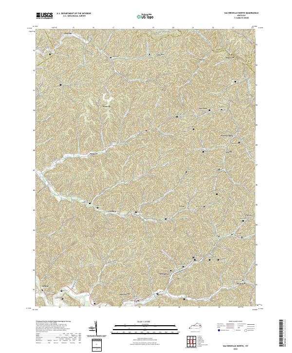
2022 Map of Salyersville North
USGS Topo · Published 2022About this map
Salyersville serves as the focal point of this Eastern Kentucky landscape, situated along the Licking River where the Magoffin County Justice Center stands as a modern civic landmark. The terrain is defined by a dense network of narrow hollows and creeks, including Buffalo Cr and Mash Fork, which have dictated the placement of small settlements and family holdings for generations. Numerous family burial grounds, such as the Christopher Gullet Cem, Tackett Memorial Cem, and David M Cooper Cem, are scattered across the ridges and valley floors, offering significant data for genealogical research.
Find a feature on this map
77 named features on this map. Tap any name to fly to it.
Don’t see what you’re looking for? This feature index may not catch every label — zoom into the map to look around manually.
Map Details
Editions of this 2022 Salyersville North Map
This is the sole edition of this map. No revisions or reprints were ever made.
Other maps of this area

1886 · Prestonsburg
USGS Topo · 1:125,000

1889 · Salyersville
USGS Topo · 1:125,000

1891 · Salyersville
USGS Topo · 1:125,000

1892 · Prestonsburg
USGS Topo · 1:125,000

1899 · Salyersville
USGS Topo · 1:125,000

1915 · Paintsville
USGS Topo · 1:48,000

1915 · Prestonsburg
USGS Topo · 1:62,500

1917 · Paintsville
USGS Topo · 1:62,500

1918 · Prestonsburg
USGS Topo · 1:62,500

1950 · Lenox
USGS Topo · 1:24,000