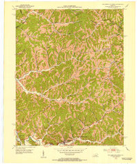
1951 Map of Salyersville North
USGS Topo · Published 1953About this map
Salyersville anchors the southern edge of this 1951 survey, situated along the Licking River at the intersection of local mountain commerce. The landscape is defined by an intricate network of narrow hollows and ridge-top settlements like Logville, Lickburg, and Wheelersburg, each connected by winding creeks and branches. An extensive distribution of Oil Wells across the eastern hillsides indicates the early post-war industrial footprint in Magoffin County.
Find a feature on this map
83 named features on this map. Tap any name to fly to it.
Don’t see what you’re looking for? This feature index may not catch every label — zoom into the map to look around manually.
Map Details
Editions of this 1951 Salyersville North Map
This is the sole edition of this map. No revisions or reprints were ever made.
Other maps of this area

1886 · Prestonsburg
USGS Topo · 1:125,000

1889 · Salyersville
USGS Topo · 1:125,000

1891 · Salyersville
USGS Topo · 1:125,000

1892 · Prestonsburg
USGS Topo · 1:125,000

1899 · Salyersville
USGS Topo · 1:125,000

1915 · Paintsville
USGS Topo · 1:48,000

1915 · Prestonsburg
USGS Topo · 1:62,500

1917 · Paintsville
USGS Topo · 1:62,500

1918 · Prestonsburg
USGS Topo · 1:62,500

1950 · Lenox
USGS Topo · 1:24,000