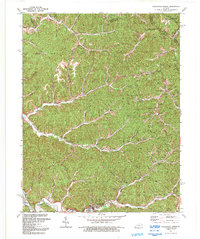
1992 Map of Salyersville North
USGS Topo · Published 1992About this map
The Licking River winds through the southern portion of this landscape, anchoring the community of Salyersville. This 1992 revision reveals a region defined by narrow valley settlements and numerous family burial grounds, such as Howard Cem, May Cem, and the Goffreed Rice Cem. The drainage patterns of Rockhouse Creek, Brushy Creek, and Cyrus Creek dictate the placement of rural enclaves like Hammond, Lickburg, and Wheelersburg. Industrial activity is evident through a network of Gas Wells and Oil Wells scattered across the ridges, while the northeastern corner is preserved within the Paintsville Lake State Wildlife Management Area. Local landmarks including the Buffalo Ch and the Ramey Mem Pk serve as community focal points amidst the complex topography of the Cumberland Plateau.
Find a feature on this map
50 named features on this map. Tap any name to fly to it.
Don’t see what you’re looking for? This feature index may not catch every label — zoom into the map to look around manually.
Map Details
Editions of this 1992 Salyersville North Map
This is the sole edition of this map. No revisions or reprints were ever made.
Other maps of this area

1886 · Prestonsburg
USGS Topo · 1:125,000

1889 · Salyersville
USGS Topo · 1:125,000

1891 · Salyersville
USGS Topo · 1:125,000

1892 · Prestonsburg
USGS Topo · 1:125,000

1899 · Salyersville
USGS Topo · 1:125,000

1915 · Paintsville
USGS Topo · 1:48,000

1915 · Prestonsburg
USGS Topo · 1:62,500

1917 · Paintsville
USGS Topo · 1:62,500

1918 · Prestonsburg
USGS Topo · 1:62,500

1950 · Lenox
USGS Topo · 1:24,000