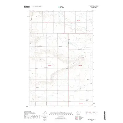
2020 Map of Sam George Hill
USGS Topo · Published 2020About this map
Manson sits in the northeast corner of this Pondera County landscape, where the high plains are defined by the winding course of the Dry Fork Marias River. The geography is shaped by numerous coulees, such as Haatvedt Coulee and DeBoer Coulee, which drain the varied elevations of Coyote Hill and the prominent Benton Bench. Centrally located, Sam George Hill rises above a network of rural routes including Coalmine Rd and Sam George Rd, indicating the local history of resource extraction and ranching access. The presence of the Conrad Reservoir and the deep incisions of Uncle Sam Coulee reflect the critical importance of water management in this Montana prairie environment. This survey captures a modern look at the township and range system, showing the persistent grid of section lines that organize the agricultural and ranching holdings of the region.
Find a feature on this map
33 named features on this map. Tap any name to fly to it.
Don’t see what you’re looking for? This feature index may not catch every label — zoom into the map to look around manually.
Map Details
Editions of this 2020 Sam George Hill Map
This is the sole edition of this map. No revisions or reprints were ever made.
Other maps of this area

1920 · Dupuyer
USGS Topo · 1:125,000

1920 · Conrad
USGS Topo · 1:125,000

1934 · Valier
USGS Topo · 1:62,500

1937 · Valier
USGS Topo · 1:62,500

1938 · Gallup City
USGS Topo · 1:62,500

1942 · Gallup City
USGS Topo · 1:62,500

1954 · Shelby
USGS Topo · 1:250,000

1958 · Shelby
USGS Topo · 1:250,000

1960 · Cut Bank
USGS Topo · 1:250,000

1963 · Cut Bank
USGS Topo · 1:250,000