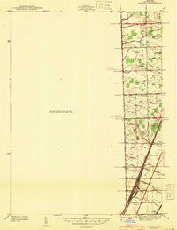
1941 Map of Samaria
USGS Topo · Published 1941About this map
Agricultural life in Monroe County dominates this 1941 survey, showing a landscape defined by an extensive network of drainage systems like Yarger Drain and Rapideau Drain. Small rural settlements such as Yargerville, Gilday, and Lookwood are centered around crossroads and country institutions, including the Yargerville Sch and Zion Ch. The southern portion of the map reveals a shift toward industrial transportation near Vienna Junction, where the Pere Marquette railroad and the massive Ottawa Yard facilitate freight movement. Local genealogists will find value in the precise locations of the St Joseph Cem and Erie Union Cem, alongside family-named roads that reflect the early 20th-century landownership patterns of Erie and La Salle townships.
Find a feature on this map
59 named features on this map. Tap any name to fly to it.
Don’t see what you’re looking for? This feature index may not catch every label — zoom into the map to look around manually.
Map Details
Editions of this 1941 Samaria Map
This is the sole edition of this map. No revisions or reprints were ever made.
Other maps of this area

1900 · Maumee Bay
USGS Topo · 1:62,500

1900 · Toledo
USGS Topo · 1:62,500

1912 · Monroe
USGS Topo · 1:62,500

1912 · Dundee
USGS Topo · 1:62,500

1914 · Monroe
USGS Topo · 1:62,500

1926 · Dundee
USGS Topo · 1:62,500

1927 · Monroe
USGS Topo · 1:31,680

1934 · Point Place
USGS Topo · 1:24,000

1936 · Samaria
USGS Topo · 1:31,680
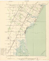
1936 · Erie
USGS Topo · 1:31,680
Featured Places
- Bedford Township, MI
- Temperance, Bedford Township
- LaSalle Township, MI
- Ida Township, MI
- Erie Township, MI