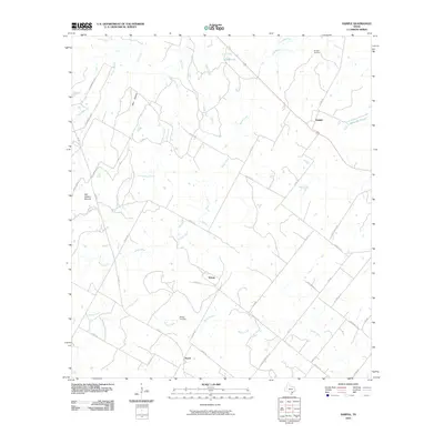
2010 Map of Sample
USGS Topo · Published 2010About this map
Sample Cemetery and the rural crossroads of Sample anchor the northern reaches of this Gonzales County landscape, where small family burial grounds and scattered farmsteads define the local history. The terrain is deeply grooved by a complex drainage network, including the meandering paths of Cottonwood Creek, Rocky Creek, and Shoats Creek, which flow toward larger systems beyond the quadrangle boundary.
Find a feature on this map
40 named features on this map. Tap any name to fly to it.
Don’t see what you’re looking for? This feature index may not catch every label — zoom into the map to look around manually.
Map Details
Editions of this 2010 Sample Map
This is the sole edition of this map. No revisions or reprints were ever made.
Other maps of this area

1920 · Smiley
USGS Topo · 1:125,000

1953 · Seguin
USGS Topo · 1:250,000

1958 · Seguin
USGS Topo · 1:250,000

1960 · Blackwell Lake
USGS Topo · 1:24,000

1960 · Cheapside
USGS Topo · 1:24,000

1960 · Westhoff
USGS Topo · 1:24,000

1961 · Sample
USGS Topo · 1:24,000
1961 · Pilgrim
USGS Topo · 1:24,000

1961 · New Davy
USGS Topo · 1:24,000
1962 · Smiley
USGS Topo · 1:24,000