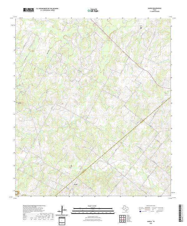
2022 Map of Sample
USGS Topo · Published 2022About this map
Nopal sits at the southwestern edge of this landscape where the Gonzales and DeWitt county line cuts diagonally through the creek-divided terrain. The map captures a rural Texas environment defined by a dense network of watercourses, including the westward-flowing Shoats Creek, Rocky Creek, and Cottonwood Creek. Local history and genealogy interest is anchored by Sample Cemetery in the northeast and Billings Cemetery near Nopal, providing vital clues for family researchers tracing early residents of these counties. Prominent land features like Van Cleave Mound and Wolf Hollow suggest the varied topography of the region, while the web of rural routes such as Hahn Rd, Schulle Rd, and Hattenbach Rd reveals the persistent layout of farm-to-market connectivity in this ranching and agricultural corridor.
Find a feature on this map
46 named features on this map. Tap any name to fly to it.
Don’t see what you’re looking for? This feature index may not catch every label — zoom into the map to look around manually.
Map Details
Editions of this 2022 Sample Map
This is the sole edition of this map. No revisions or reprints were ever made.
Other maps of this area

1920 · Smiley
USGS Topo · 1:125,000

1953 · Seguin
USGS Topo · 1:250,000

1958 · Seguin
USGS Topo · 1:250,000

1960 · Blackwell Lake
USGS Topo · 1:24,000

1960 · Cheapside
USGS Topo · 1:24,000

1960 · Westhoff
USGS Topo · 1:24,000

1961 · Sample
USGS Topo · 1:24,000
1961 · Pilgrim
USGS Topo · 1:24,000

1961 · New Davy
USGS Topo · 1:24,000
1962 · Smiley
USGS Topo · 1:24,000