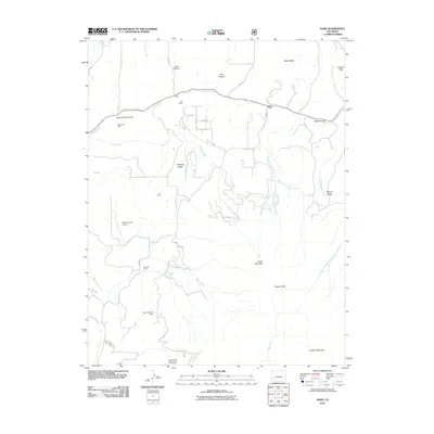
2011 Map of Sams
USGS Topo · Published 2011About this map
Dallas Divide serves as a prominent geographic and transit waypoint in this San Miguel County landscape, where the high-altitude terrain is carved by the complex drainage of Leopard Creek and its many branches. The map captures a high country economy transitioning from its industrial roots to a mix of ranching and recreation. Mining history is deeply etched into the topography, with sites like the Bear Creek Mine in the north and the Yellow Medicine Mine further south near Last Dollar Mountain.
Find a feature on this map
43 named features on this map. Tap any name to fly to it.
Don’t see what you’re looking for? This feature index may not catch every label — zoom into the map to look around manually.
Map Details
Editions of this 2011 Sams Map
This is the sole edition of this map. No revisions or reprints were ever made.
Other maps of this area

1897 · Telluride
USGS Topo · 1:62,500

1904 · Telluride
USGS Topo · 1:62,500

1909 · Montrose
USGS Topo · 1:125,000

1911 · Montrose
USGS Topo · 1:125,000

1945 · Durango
USGS Topo · 1:250,000

1953 · Placerville
USGS Topo · 1:24,000
1953 · Gray Head
USGS Topo · 1:24,000

1953 · Little Cone
USGS Topo · 1:24,000

1953 · Durango
USGS Topo · 1:250,000

1954 · Durango
USGS Topo · 1:250,000