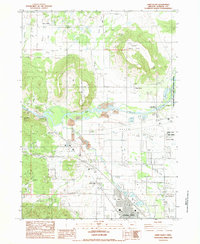
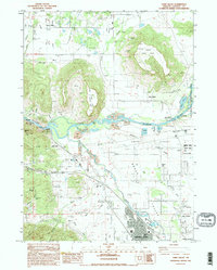
1983 Map of Sams Valley
USGS Topo · Published 1983About this map
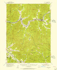
The Rogue River flows through this Jackson County landscape, defining a valley dominated by the dramatic geological formations of Upper Table Rock and Lower Table Rock. During the early 1980s, the area around Central Point showed significant industrial and utility development, including a sewage plant, pumping station, and a radio facility atop the plateau. The map preserves several historical layers of the region, from the Fort Lane (Site) near Tolo to the extractive legacy of the Millionaire Mine and numerous gravel pits along the Bear Creek corridor. Water management is a central theme of the terrain, visible through the complex network of the Kelly Ditch, Curry Ditch, and the Gold Ray Dam. To the east, the Agate Desert stretches toward the Ken Denman State Game Management Reserve, illustrating the varied land use between agricultural flats and protected habitats.
Find a feature on this map
55 named features on this map. Tap any name to fly to it.
Don’t see what you’re looking for? This feature index may not catch every label — zoom into the map to look around manually.
Map Details
Editions of this 1983 Sams Valley Map
2 editions found
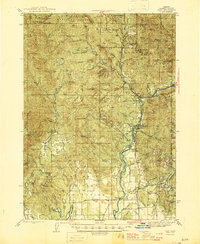
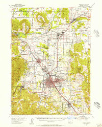
Other maps of this area

1891 · Ashland
USGS Topo · 1:250,000

1893 · Ashland
USGS Topo · 1:250,000

1897 · Ashland
USGS Topo · 1:250,000

1904 · Riddle
USGS Topo · 1:125,000

1908 · Grants Pass
USGS Topo · 1:125,000

1938 · Medford
USGS Topo · 1:125,000
1943 · Trail
USGS Topo · 1:62,500
1954 · Medford
USGS Topo · 1:62,500
1954 · Gold Hill
USGS Topo · 1:62,500
1954 · Wimer
USGS Topo · 1:62,500