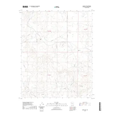
2020 Map of Samson Lake
USGS Topo · Published 2020About this map
Torrivio Ridge and Torrivio Mesa anchor this landscape within the Eastern Navajo Agency, showing a terrain defined by high mesas and deep drainages. The map reveals a network of local roads and named loops, such as Pittsburg Loop and Tseyatay Loop, that navigate the complex topography of McKinley County. Water sources are critical landmarks in this arid environment, represented by the namesake Samson Lake, as well as Manuelito Spring and Parker Spring. The drainage of Leo Canyon and the open expanse of Blue Grass Flat illustrate the varied landforms that have long influenced movement and settlement patterns in this part of New Mexico. Small residential roads like Midway Dr and Sunset Valley Rd branch off from more established routes like Defiance Draw Rd, marking the modern development of the area.
Find a feature on this map
27 named features on this map. Tap any name to fly to it.
Don’t see what you’re looking for? This feature index may not catch every label — zoom into the map to look around manually.
Map Details
Editions of this 2020 Samson Lake Map
This is the sole edition of this map. No revisions or reprints were ever made.
Other maps of this area

1886 · Wingate
USGS Topo · 1:250,000

1886 · Fort Defiance
USGS Topo · 1:250,000

1892 · Fort Defiance
USGS Topo · 1:250,000

1892 · Wingate
USGS Topo · 1:250,000

1954 · Gallup
USGS Topo · 1:250,000

1955 · Zith-Tusayan Butte 4 NE
USGS Topo · 1:24,000

1958 · Gallup
USGS Topo · 1:250,000

1959 · Gallup
USGS Topo · 1:250,000

1962 · Gallup
USGS Topo · 1:250,000

1963 · Twin Lakes
USGS Topo · 1:24,000